
120+
Supported
Countries

15+
Completed
Projects

5+ TB
Processed
Geospatial Data

800+
CPU
Hours

policy-makers

land use planners

land users

organisations / agencies
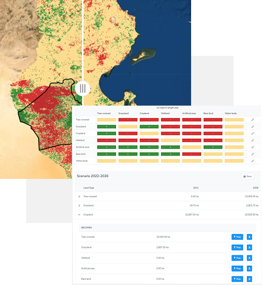
LUP4LDN is a tool that greatly helps us to understand where to focus restoration activities and design scenarios for reducing land degradation

Mrs. Attia Rafla
Ministry of Agriculture, Tunisia